Questions and answers about geophysical services from 35 select archives
Geophysics is not for everyone and is project dependent. Over the years, many people submitted questions and comments about what they wanted to investigate. As you will see, some ideas were good and some ideas needed more discussion. To find out more about geophysical methods, visit the home page.
Looking for UST says:
October 18, 2012 at 12:41 pm
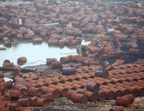
I have a property in Chicago that may have a underground storage tank. Can you do a GPR survey?
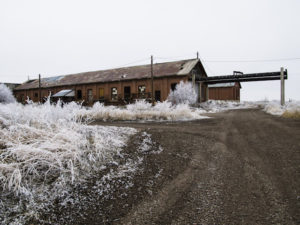
Geophysics to Locate UST in Winter
Reply
geophysics says:
October 18, 2012 at 4:02 pm
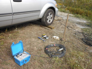
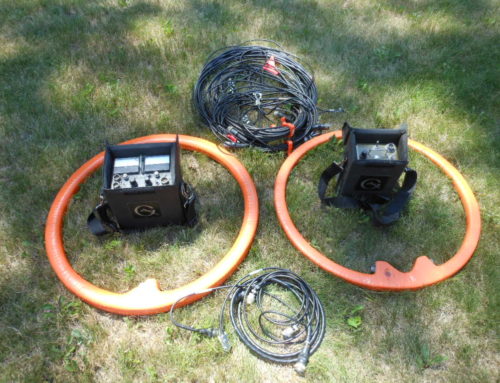
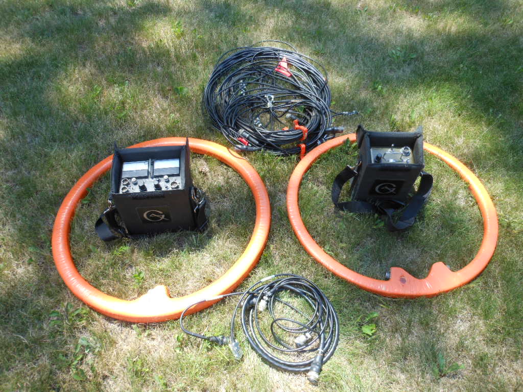
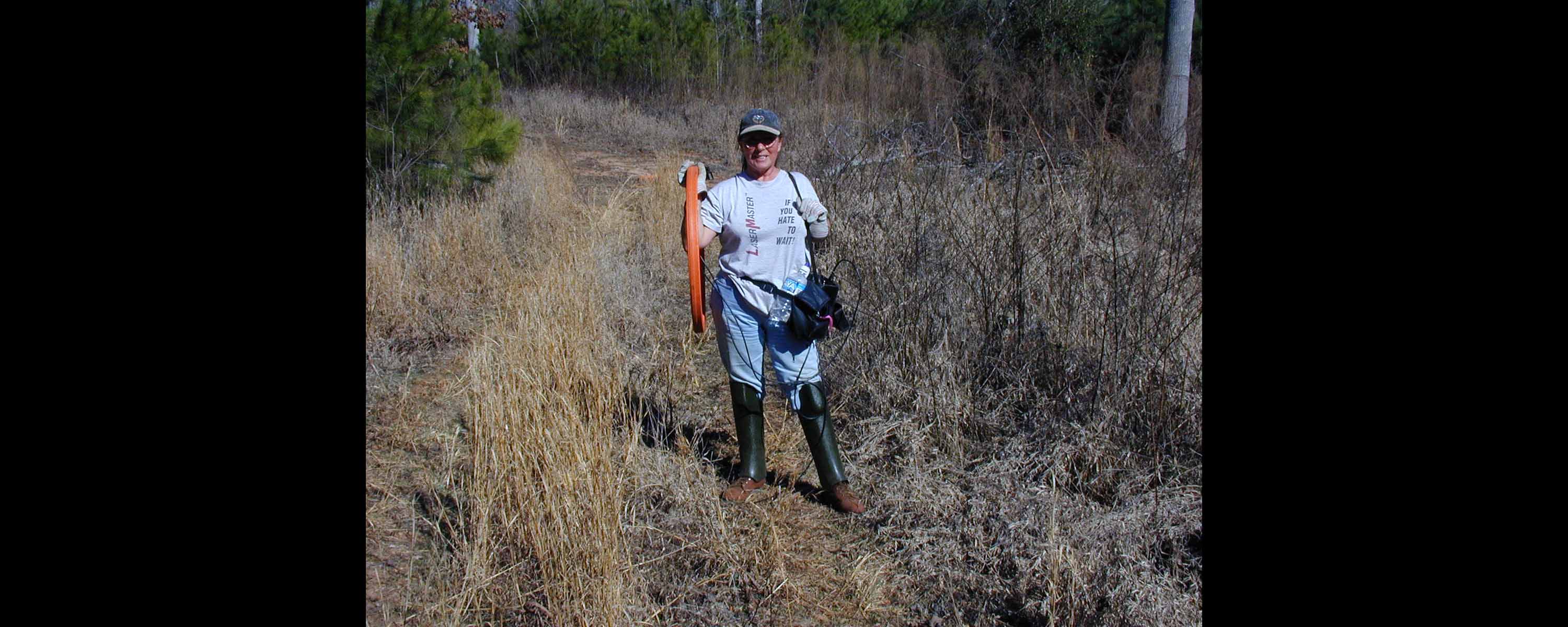
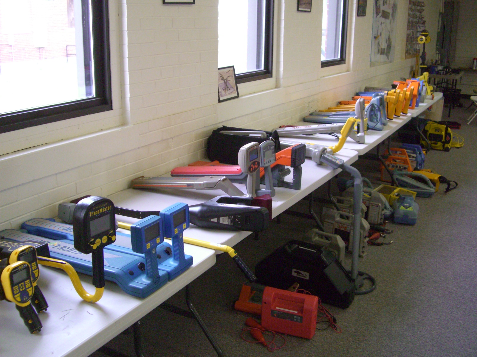
Yes. But you may want to reconsider using ground penetrating radar. Because of the clay rich soils GPR, in the Chicago area, does not always yield desirable results. In addition, many places in the downtown area have fill from the Chicago fire, which can complicate the GPR response. At a site with clay rich soils, ground penetrating radar may work well for trying to map an excavation filled with gravel. There are times when GPR locates a UST covered with gravel. Most geophysical surveys for buried underground storage tanks in Wisconsin and Illinois are found using a magnetometer (Geometrics G-858 or G-856) and a Geonics EM-31 or EM-61. The EM-61 is only for buried metal while the EM-31 measures variations in apparent conductivity. Like GPR, electromagnetic instruments do not work very well over concrete with reenforcing material. A magnetometer may yield desirable results over concrete that has a limited amount of mesh or rebar. It is also important that the UST has enough iron to yield a response that is greater than the magnetic anomalies generated by nearby cultural features.
Reply
Shear Wave Survey says:
November 8, 2012 at 9:05 am
RFP is asking to geophysically measure the shear wave velocities. Where do I find a shear wave meter.
Reply
geophysics says:
Shear Wave Geophysics
November 8, 2012 at 2:15 pm
Geophysically, a geophysicist uses a seismograph to measure the response of a seismic pulse that passes through the earth. For shear wave velocities there are three common methods, borehole to surface, borehole to borehole, and multichannel analysis of surface waves MASW. Seismic refraction surface methods are used often for P-wave velocities. Each method has its pluses and minuses. There are ASTM standards available for the borehole methods. However, MASW is popular and often yields a cross-sectional panel of shear wave velocity verses depth. Some of the issues to consider are if you want to drill boreholes, do you have someone who can properly complete the boreholes, is traffic or other cultural features a problem, and what degree of horizontal and vertical resolution do you need. This response will send an email back to you. If you want, email me or call me at 262-242-4280 to follow up with this project.
Reply
Levee Certification says:
December 12, 2012 at 4:26 pm
Have an industrial park being built next to a levee. What geophysical methods do you have to map sands and gravels. There are several hundred acres.
Reply
geophysics says:
December 13, 2012 at 9:34 am
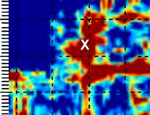
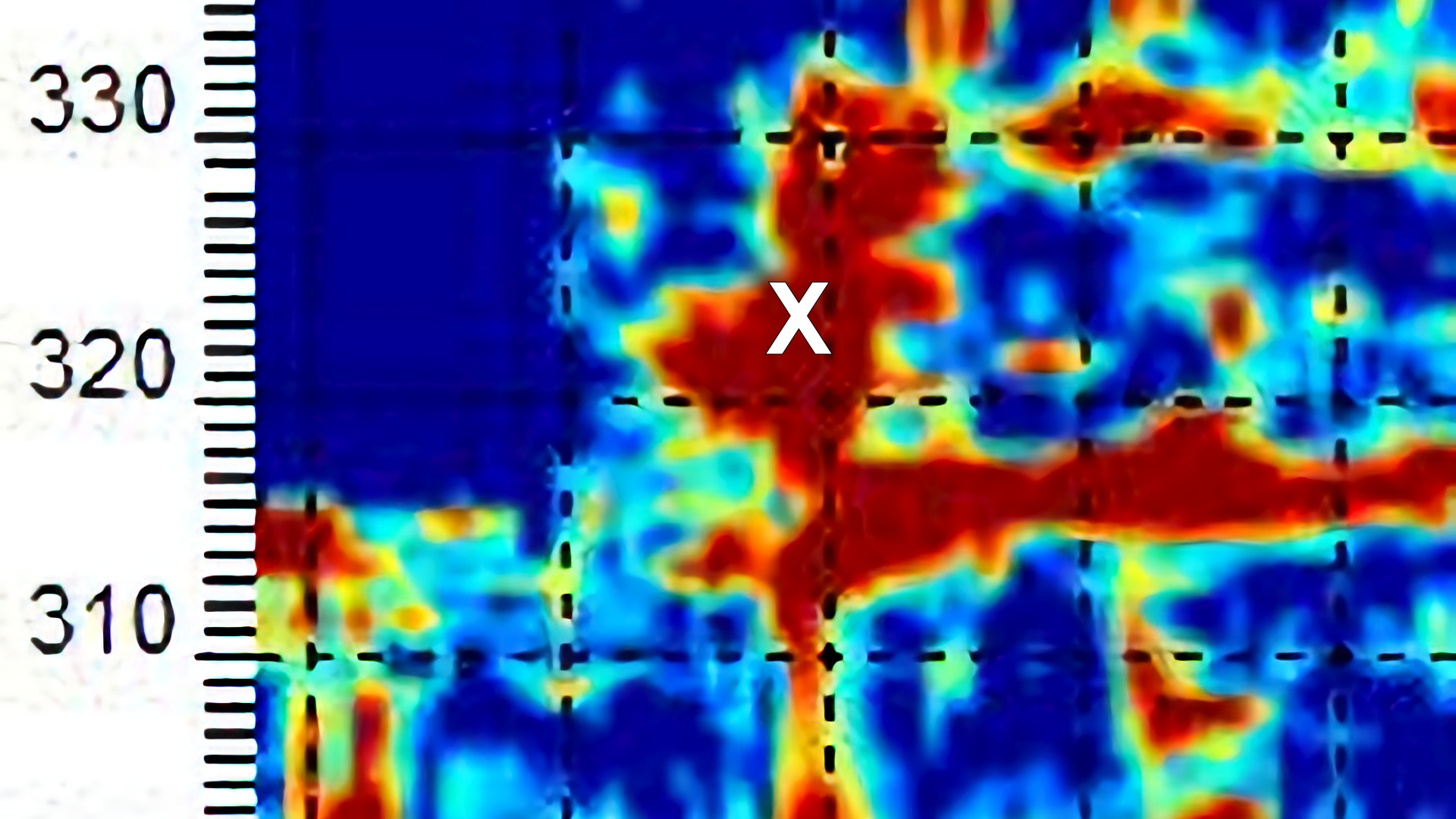
There are several shallow near surface geophysical methods. With the exception of MASW, mapping variations in soils is often done using electrical resistivity methods or electromagnetic terrain conductivity methods. The first question to ask is if you need to focus on great geologic detail along a cross section or do you want to get an idea of how the soils vary laterally a
Geophysics and Levees
cross the site (e.g., plan view map). A combination of both geophysical approaches can be cost effective. For example, a Geonics EM-31 survey or a Geometrics OhmMapper capacitance coupled resistivity survey can cover most of the site. The EM-31 reaches depths of penetration of about 15 to 20 feet while the OhmMapper can be configured for various depths of penetration. Data is acquired or collected along enough lines to create a contour map of variations in apparent electrical resistivity or apparent conductivity. Assuming all factors are constant except for variations in the electrically conductive clay content, increases in apparent conductivity or decreases in electrical resistivity are generally associated with increases in the clay content. There are other factors involved but this is the general idea. After the site is spatially characterized, more specific areas of concern are identified for more detailed analysis. Greater detail of how the electrical properties of the soils vary with depth can be characterized by conducting additional multiple passes with the capacitance coupled OhmMapper or by conducting a multielectrode earth resistivity survey with an instrument like a SuperSting R8. EM methods can provide additional detail but they are not always a practical approach. The two resistivity instruments can produce resistivity images in cross section by acquiring a large volume of apparent resistivity values. The resistivity data is associated with various distances along the line and with various depths of penetration. Many times many 1000’s of readings are compiled for modeling. There is no such thing an unique geophysical model; however, as the volume of resistivity data increases the more likely the modeling process produces a plot representing the actual conditions at depth. If you wish to know more, give me a call at 262-242-4280.
Reply
Winter Geophysics says:
February 2, 2013 at 3:13 pm
I have projects coming up that need geophysics. They have pushed off all summer. What will stop GPR, EM-31, and magnetometer surveys from working?
Reply
geophysics says:
February 3, 2013 at 11:18 am
Geonics EM-31, Geometrics G858 magnetometers, and Sensors & Software’s GPR systems are a capable of acquiring geophysical data during the winter months. The EM-31 and the magnetometer do not come in contact with the ground. Ground penetrating radar, like the PulseEKKO and Noggin systems, are more or less in contact with the ground at all times. While ice and solid snow are not usually an issue, slushy snow, water, and, especially, water from salting can be a real problem for GPR. Snow thickness can also be a problem for GPR. The higher the frequency antenna the closer the antenna needs to be in contact with the ground, for good coupling. Often piles of snow limit access and make it difficult to identify buried objects that may produce a false positive. Extreme cold can be a health risk for the operator and shortens the battery life on the geophysical instruments.
Reply
GPR and Water says:
May 11, 2013 at 9:34 am
Your last post discusses GPR in wet snow. This has been a very wet spring, can we use GPR?
Reply
geophysics says:
May 11, 2013 at 2:12 pm
GPR and Water
The lower the frequency of the ground penetrating radar antenna the less of an issue water can be. However, water should always be considered a problem. Puddles can cause time shifts in the GPR data as well as possibly damaging the system. Water in the Spring time may also lead to greater saturation of the near surface soils, which would also limit penetration of the GPR signal. In some rare cases, differential saturation could assist with locating trenches and other types of excavations.
Reply
Landfill Cap says:
August 15, 2013 at 1:55 pm
I need to confirm the extents of a landfill cap. It was covered with a good clay. What do you suggest?
Reply
geophysics says:
August 15, 2013 at 3:58 pm
Are you looking to geophysically locate the landfill contents or just the cap? What type of soils are outside the boundary of the landfill cap?
Reply
Landfill Cap says:
August 19, 2013 at 10:01 am
Just landfill cap. Glacial till with course grained material.
Reply
Geophysics to Find a Landfill Cap
geophysics says:
August 20, 2013 at 11:53 am
Areas where the landfill cap is many feet thick, a
Geonics EM-31 or a Geonics EM-31 short may do well. If you are concerned about areas where the cap is fairly thin, say less than a few feet or so, then a Geonics EM38 would possibly be a good geophysical instrument to use. These three electromagnetic terrain conductivity meters can cover spatially large areas in a fairly short amount of time. A multi electrode electrical resistivity imaging survey often provides some of the greatest vertical detail. It would assist with determining layer thickness. Given the cap is a good clay rich (electrically conductive) material, GPR would likely have a tough time penetrating very deep into or through the clay cap, which in itself may be a good enough indicator. Logistically, GPR could be difficult to use, especially if the area is covered with heavy grass or brush.
Reply
Wenner Soil Resistivity says:
November 2, 2013 at 7:04 am
The power company asked if we can find someone to do Wenner 4 pin electrical resistivity soil measurements with our soil borings. Do you do this test?
Reply
Wenner Soil Electrical Resistivity
geophysics says:
November 2, 2013 at 8:24 am
An electrical resistivity sounding is a standard geophysical test. I have completed Wenner four pin electrical resistivity soundings with electrodes spaced far enough part to penetrate over 500 feet and electrodes spaced close enough to penetrate less than one foot. To reach depths pushing a 1000 feet, it takes many 1000’s of feet of wire and permission to access adjacent properties. Please call with additional details and if you have any standards your client wishes to use. ATC often has its own recommendations. ASTMG57 is often quoted as a guideline.
Reply
Locate Graves says:
January 30, 2014 at 2:20 pm
Our company has a project where we need to locate unmarked graves before construction. GPR was discussed but I know it is not the only geophysical method. What can you tell me?
Reply
geophysics says:
February 3, 2014 at 5:25 pm
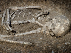
Archaeological Geophysics to Find Graves
I have completed numerous geophysical surveys to locate marked and unmarked graves. It can be a difficult task. While unmarked graves are clearly lost, marked graves are sometimes a greater challenge. As archaeologist, historians, and cemetery grounds keepers are well aware of, the location of a burial is not always adjacent to the marker or headstone. Pauper’s graves can be difficult because they may be placed a long distance away from marked graves. I found that no one geophysical method works. Ground penetrating radar ( GPR ) provides some of the most spectacular results, in good record areas. Other geophysical instruments to consider are magnetometer, Geonics electromagnetic terrain conductivity meters (EM-31, EM31 short, and EM-38), Geometrics OhmMapper (capacitance coupled resistivity), and multi-electrode electrical resistivity imaging methods (like a SuperSting).
Reply
Locate Graves says:
February 5, 2014 at 11:41 am
It is good to know there are options. We will call when we find out more about the schedule.
Reply
Find Buried Well Case says:
June 3, 2014 at 3:43 pm
We have an old well located on the farm. My father used it for irrigation. We need to find it.
Reply
geophysics says:
June 4, 2014 at 10:36 am
Obviously the well casing is cut off below ground level. Do you know how far down it was cut off? What size casing was it? Was there any other buried piping? How much casing was used or how deep is it to bedrock?
Reply
Locate a Monitoring Well With Geophysics
Find Buried Well Case says:
June 9, 2014 at 1:49 pm
The case and the abandoned electric power line has not been hit with a plow, so maybe a couple feet deep. Bedrock no idea. Think there is 100 feet of casing.
Reply
geophysics says:
June 10, 2014 at 6:17 pm
There are a few geophysical methods available. A Geometrics G-858 Cesium Vapor magnetometer works very well for locating iron, especially a 100 foot long vertical iron pipe. The abandoned private electric line would likely show up as buried metal using electromagnetic methods, like a Geonics EM-31 or EM61. An underground line locator, used in the induction mode or as a two man sweep, is designed to locate buried electric or metal piping. Locating several portions of the line near the well would likely point you towards the vicinity of the abandoned well.
Reply
Lost Excavations says:
September 8, 2014 at 7:21 am
Please contact me (contact info deleted for public view) about ER imaging old excavations beneath a heavy duty asphalt parking lot.
Reply
geophysics says:
September 8, 2014 at 10:14 am
Electrical resistivity imaging uses multi-electrode arrays. The geophysical theory behind detecting or characterizing a feature at depth using electrical resistivity methods is strongly dependent on the electrical contrast between materials and the spatial size of the target. What are the soils surrounding the excavation and what type of material was used to fill the excavation?
Reply
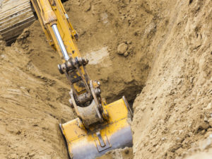
Locating Lost Excavations Trenches Wit Geophysics
Lost Excavations says:
September 8, 2014 at 11:33 am
The excavations are in clay rich soils and were filled with crushed limestone. The holes are about 15 feet wide and 10 feet deep. The parking lot may have more then 10 inches of asphalt, is that a problem?
Reply
geophysics says:
September 8, 2014 at 1:12 pm
Geophysically, the electrical contrast between the electrically conductive clay rich soils and the electrically resistive crushed limestone is good. The asphalt makes it more difficult and time consuming to conduct the survey. My greatest concerns about the asphalt is the amount of time it will take to drill holes and place electrodes. The electrodes need to be long enough to penetrate well past the bottom of the asphalt. The holes need to be large enough to accept a fair amount of water, especially if there is a thick gravel base. For good results, the electrodes need to have good contact with the material under the asphalt.
Reply
Detecting Sewer Lines says:
December 3, 2014 at 9:42 am
I have a sewer line that is trenched in, like the excavation talked about in a previous comment. Can we try using an electrical resistivity test to find the sewer. It is 2 to 3 feet in diameter.
Reply
geophysics says:
December 3, 2014 at 12:45 pm
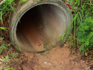
Locate sewer and drain lines using geophysics
We can try electrical resistivity imaging, but it may not be the most cost effective geophysical method. I have mapped sewer lines using a Geonics EM31, but it is strongly dependent on site conditions and the size of the sewer line. While ground penetrating radar may or may not respond to the sewer line, a tightly spaced grid with perpendicular transect lines has yielded desirable results. Often one can map the trench, in an area that has clay rich soils. In sandy soils, one may map the GPR response from the sewer line. From a theoretical geophysics point of view, lines should not need to be too closely spaced for large targets. Especially if one is collecting GPR data, more or less, along lines that are perpendicular to the sewer line. However in my opinion, it has become more obvious that some of the best plan view GPR maps of trenches for sewer lines are generated from perpendicular transects spaced less than 3 feet apart. I believe, it has more to do with the interpolation and extrapolation routines of the presentation software than issues with sampling. As with any geophysical method, if you do not find what you are looking for it does not mean it is not there.
Reply
Costs for Borehole Geophysics says:
March 1, 2015 at 8:02 am
I need to conduct a suite of borehole measurements. How much does it cost?
Reply
geophysics says:
March 1, 2015 at 10:05 am
That is a loaded question. What geophysical borehole tools do you need? How deep do you need to go?
Reply
Cost for Borehole Geophysics
Costs for Borehole Geophysics says:
March 3, 2015 at 9:48 am
I thought maybe there was a daily rate. The holes are PVC cased and less than 125 feet deep.
Reply
geophysics says:
March 3, 2015 at 3:12 pm
I can work up a daily rate; however, there is a big difference in costs between some of the basic borehole tools and something like an Acoustic Televiewer. In some cases, using basic tools in combination with the more sophisticated borehole tools can nearly double the cost. Let me know when you find out more.
Reply
UST Geophysics Survey says:
May 8, 2015 at 7:13 am
What is your availability for geophysically surveying 3 sites.
Reply
geophysics says:
May 8, 2015 at 10:19 am
It is obvious that 2015 is a good year for land development. I have had a numerous requests for Geonics instruments, magnetometer surveys, ground penetrating radar, and multi-channel analysis of surface waves MASW. Availability is becoming more limited. Send an email through the contact form or call.
Looking for USTs

